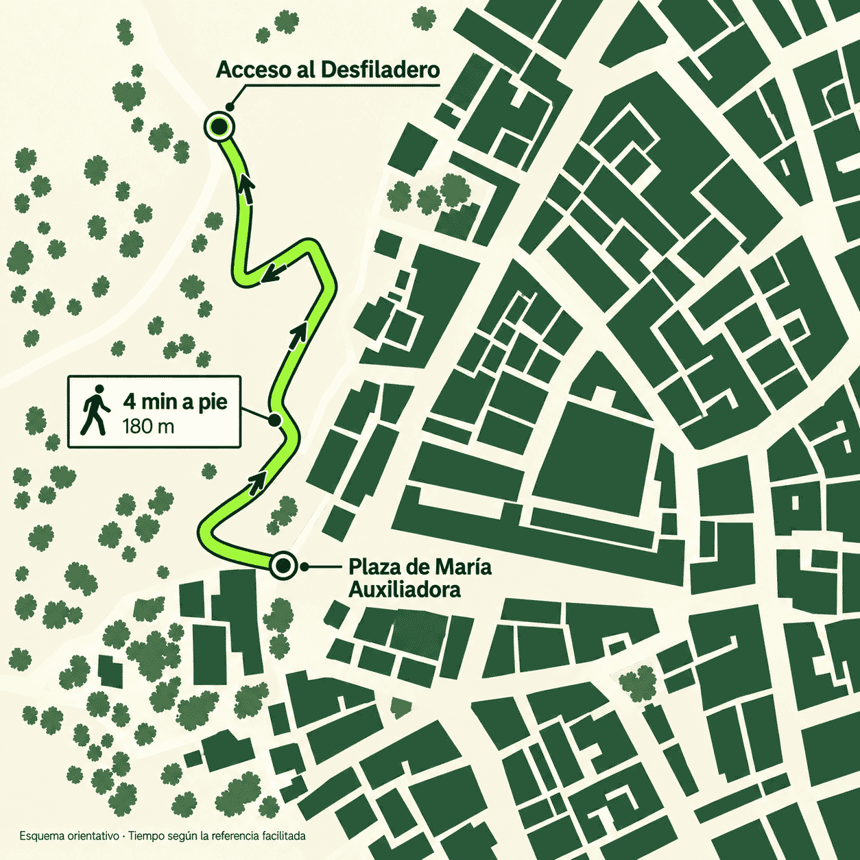
The Desfiladero entrance is about 180 m from Plaza de María Auxiliadora in Ronda: take the path down that starts at the end of its balconies over the valley. It is about a 4-minute walk.
At Plaza de María Auxiliadora, look for the path down at the end of the balconies overlooking the valley. The map helps you recognise its bends on the way to the entrance.
4 minon foot · indicative
180 mfrom the square to the entrance
Indicative time and distance from the supplied map. These cover the approach to the entrance, not the duration of the visit.
Plaza de María Auxiliadora →︎ Desfiladero entrance
01
Arrive in Ronda
Check your route and plan where to leave your vehicle.
02
Find the square
Your landmark is Plaza de María Auxiliadora.
03
Walk down to the entrance
Follow the map and your booking instructions.
02 / GET TO RONDA
Where are you coming from?
Open your route in Google Maps for directions and current journey conditions when you set off. These routes end in Ronda; plan where to park and then continue on foot.
The map marks the square, not the Desfiladero entrance. Google Maps will ask for a starting point if your location is unavailable.
Before you start walking down.
Distinguish the entrance from the exit
The Town Council’s announcement of the completed route places it between the area of Plaza de María Auxiliadora and the Padre Jesús neighbourhood, beside the Baños Árabes, the Arab baths. It states that the entrance and exit occupy restored buildings. To start your visit, use the entrance instructions; do not treat the Baños Árabes landmark as your meeting point.
Before setting off for the route
Check your booking for where to report and at what time. If you arrive by car, plan parking and the walk separately. If you are already exploring Ronda, check how to reach the square from your location. Avoid scheduling another activity immediately after your visit without checking its conditions first.
If the directions do not match
If your booking confirmation says something different or you cannot recognise the path when you arrive, ask the team before continuing along another trail. You can use the contact link below. The practical guide brings together the access conditions and preparation checklist to help you get ready.
Visitor information based on the Desfiladero website. History and geology based on the 2023 municipal dossier and the project report. Check the current conditions before booking.